Arctic Grid
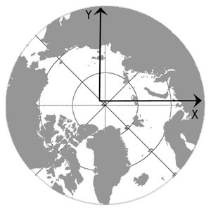
The GlobICE system uses a polar stereographic map projection covering areas north of 60° North.
The grid has the following projection parameters:
projection: Polar Stereographic
latitude of true scale: 70° North
grid spacing: 100 metres
ellipsoid: Hughes
radius: 6378.273 km
eccentricity: 0.081816153
meridian of x axis: 45° East
meridian of y axis: 135° East
origin: 90° North, 45° West
The latitude of true scale is chosen to minimise distortion at the marginal ice zone, while distortion at the North pole is about 3%.

Antarctic Grid
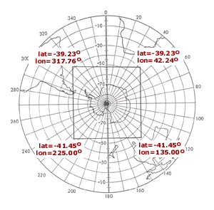
For the prototype Antarctic products, the GlobICE system uses the same grid as that used by the National Snow and Ice Data Center for its ice products.
The grid has the following projection parameters:
projection: Polar Stereographic
latitude of true scale: 70° South
grid spacing: 100 metres
ellipsoid: Hughes
radius: 6378.273 km
eccentricity: 0.081816153
meridian of x axis: 0° East
meridian of y axis: 90° East
origin: 90° South, 180° East
