
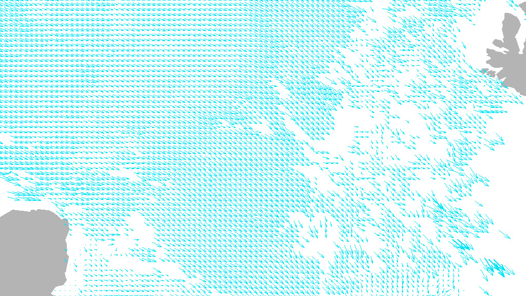
Fram Strait (5km Grid)
The GlobICE information system produces ice motion products on a grid spacing of 5km, as shown in this 3-day average ice velocity plot for the Fram Strait on 3rd January 2009. The area is about 600 km across. Landmasses, depicted in grey, are Greenland to the west, and the islands of Svalbard to the east. Arrow length is proportional to ice velocity.
(Credit: UCL/ESA/Planetary Visions)
Click here for full-size image
>>> Return to Gallery